The 1980 Groundwater Management Act includes provisions to help prevent this scenario. Under the Act, there are two kinds of areas in which groundwater is regulated:
1. Irrigation Non-Expansion Areas (INAs) – wells larger than small residential wells are metered, and their groundwater use is reported annually. In addition, there is a prohibition on new irrigated agriculture (defined as two or more acres).
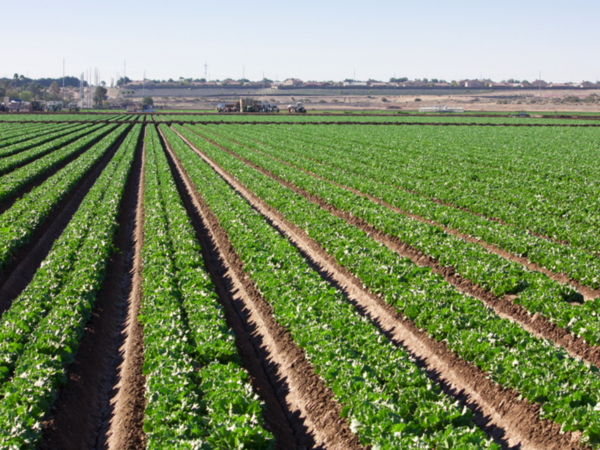
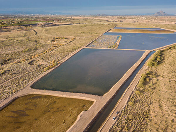
2. Active Management Areas (AMAs) – metering and reporting of groundwater use; prohibition on new irrigated agriculture; developments of six or more homes cannot be platted without proof of a 100-year supply of water that is physically, financially, and legally available. Every ten years, ADWR develops a new management plan for each AMA, with increasingly rigorous conservation and efficiency requirements for all sectors. Agriculture tends to be the biggest water-using sector, and since 1980, new irrigated agriculture has been prohibited within the AMAs and Irrigation Non-Expansion Areas. (No such prohibition is in place outside the AMAs and INAs, which is why some parts of the state have seen an influx of industrial-scale, groundwater-dependent agriculture.) Farms with grandfathered wells are permitted to pump groundwater to irrigate their crops. Energy costs to pump groundwater are a consideration for farmers, particularly as the water table falls and more energy is required to pump it for use. At some point, the energy costs may render some types of irrigated agriculture unprofitable.
Usually, if municipal water is available it is much less expensive and far more reliable than water from an individual private well. Outside AMAs and INAs, there is virtually no regulation on the amount of water a well owner can pump.
Central Arizona municipal water providers will continue to adapt to ensure sufficient and resilient water supplies. Past successes include significant reductions in the use of water per capita through conservation, the extensive use of reclaimed water, the development of diverse water portfolios that include Colorado River water and local Salt and Verde River watersheds, the banking of Colorado River and reclaimed water underground in local aquifers and collaborative regional planning that includes leases and exchanges of both water and infrastructure.
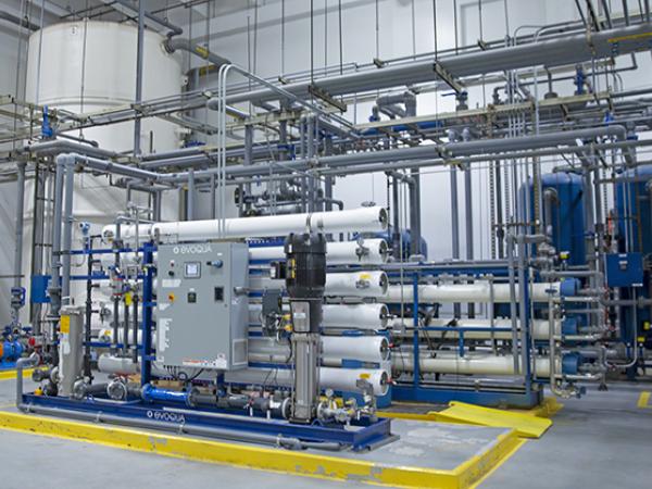
Additional adaptations may include enhanced conservation, land-use planning that includes incentivizing development on lands with better access to renewable surface water supplies, new and innovative regional partnerships to exchange and lease water and leverage infrastructure between municipal water providers, new infrastructure to treat and deliver wastewater as drinking water, increasing the capacities of local reservoirs, transferring high-priority Colorado River water into Central Arizona via purchase or lease and importation of new water supplies such as desalinated ocean water or brackish groundwater.
Outside of Central Arizona, groundwater, surface water, brackish groundwater desalination, and ocean desalination projects are being implemented. These include the Yuma Desalting Plant, the North Central Arizona Pipeline, and the Binational Desalination Plant located in the Sea of Cortez. Learn more.
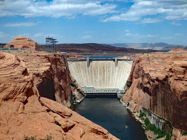
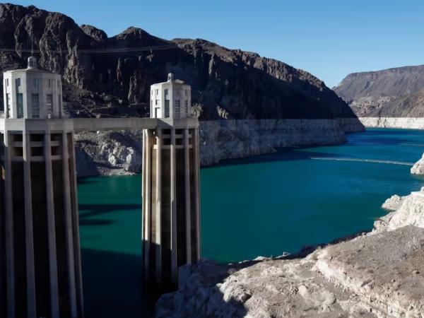
Surface water is water found on the surface of the earth. Arizona gets its surface water primarily from the Colorado River and the local Salt and Verde River watersheds, though there are surface waters found in rivers, creeks, and lakes throughout the state.
Tools
ASU is innovating agriculture for a more food-secure future
Agriculture is as old as our state — older, in fact — yet today's approaches to our food supply are anything but. From AI drones to supply routes that get produce from farm to table faster, advances in agriculture are…
Grassland Productivity Forecast
Every spring, ranchers face the same difficult challenge—trying to guess how much grass will be available for livestock to graze during the upcoming summer. This new grassland forecast is the result of a collaboration…
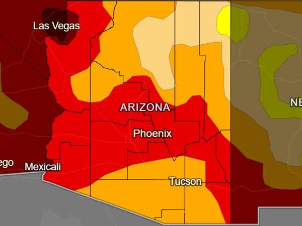
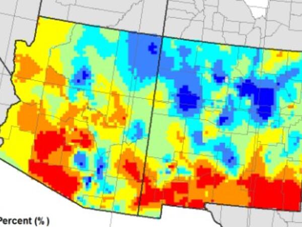
National Drought Monitor: Arizona
The U.S. Drought Monitor depicts the location and intensity of drought across the country and is updated weekly. The map is jointly produced by the National Oceanic and Atmospheric Administration, U.S.…
Arizona Water Blueprint
Explore Arizona's water with the Arizona Water Blueprint, a data rich tool developed by the Kyl Center for Water Policy at ASU.
Groundwater Use Rights Map
A comprehensive map of Arizona groundwater rights and irrigation authority based on location, intended for use by owners of irrigation grandfathered rights, owners of Type 1 non - irrigation GFRs, irrigation…

Rural Water in Arizona Map
A deep dive into rural water concepts in Arizona, including lack of regulation, pressure hotspots on groundwater supplies, and the effect wells have on adjacent rivers or streams via a map interface. Developed by the Kyl…
Fact sheets
ASU is innovating agriculture for a more food-secure future
Agriculture is as old as our state — older, in fact — yet today's approaches to our food supply are anything but. From AI drones to supply routes that get produce from farm to table faster, advances in agriculture are…
Arizona Guide to the Expiration of the 2007 Operating Guidelines for Lakes Powell and Mead
In response to drought and declining reservoir levels, in 2007 the seven states that share Colorado River water agreed to new guidelines for managing the system; the guidelines and additional measures will expire in…

Using the Arizona Water Chatbot
The Arizona Water Chatbot (informally, AZ Waterbot) is an AI-powered chatbot developed by the Arizona Water Innovation Initiative that delivers information about water management, water conservation and drought to…
Untangling Housing Affordability & Groundwater Regulation
To ensure long-term water supplies for current residents, the state has imposed limitations on some new housing subdivisions and other types of development. While the new limitations may increase the costs of new homes in…
Arizona Water Factsheets
These county-level factsheets from the University of Arizona's Water Resources Research Center are designed to answer common questions about water resources, tailored to every county in Arizona so as to foster…
Research and policy briefs
ASU is innovating agriculture for a more food-secure future
Agriculture is as old as our state — older, in fact — yet today's approaches to our food supply are anything but. From AI drones to supply routes that get produce from farm to table faster, advances in agriculture are…

Technology Roadmap: Sea of Cortez Desalination
The Sea of Cortez Desalination Roadmap encompasses the project scope and considers the magnitude of an intake in a sea with high tidal fluctuations, a desalination plant, and long-distance conveyance with extensive…
Technology Roadmap: Industrial Water
This Technology Roadmap for industrial water summarizes drivers and research opportunities that support industrial water recycling and onsite reuse.
Technology Roadmap: Brackish Groundwater
Brackish groundwater represents the largest unallocated water resource in the state of Arizona, “with more than 600 million acre-feet (AF) of recoverable brackish groundwater in storage.”
Technology Roadmap: Atmospheric Water Extraction (AWE)
Water extracted from the atmosphere is essentially pure water, therefore, atmospheric water extraction (AWE) holds great potential to produce freshwater with high water quality.

Technology Roadmap: Executive Summary
From the Global Center for Water Technology, an overview of technology roadmaps.
Newsletters
Interested in keeping up with our events, news, and resources? Sign up for our newsletter today!
Sign up
Videos and webinars
ASU is innovating agriculture for a more food-secure future
Agriculture is as old as our state — older, in fact — yet today's approaches to our food supply are anything but. From AI drones to supply routes that get produce from farm to table faster, advances in agriculture are…
Water and the West
Some 40 million people in the American West rely on water from the Colorado River. But the river’s flow has diminished, and those decreases will likely continue. Grady Gammage Jr. and Sarah Porter of Arizona State…

Understanding the Complex Fight Over Arizona's Water
Arizona recently announced new constraints on housing development in the areas around Phoenix. At issue is water scarcity, which has always been a challenge for the US Southwest. On this episode of Odd Lots from…
What About Water? podcast
"What About Water? with Jay Famiglietti" connects water science with the stories that bring about solutions, adaptation, and action for the world's water realities. Presented by Arizona State University and the University…

About the Arizona Water Blueprint webinar
The Arizona Water Blueprint is a data-rich, interactive map of Arizona’s water resources and infrastructure. Offering data visualizations and in-depth multimedia content on important water-related topics, the Water…
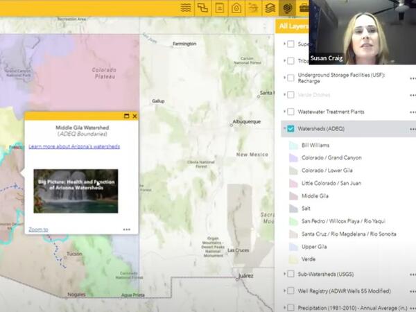
Arizona Water Blueprint webinar
Susan Craig and Sarah Porter from Arizona State University discuss water issues in Arizona and the Arizona Blueprint, which allows users to visualize water information across the state.