Impacts of Colorado River water shortages on agriculture in Central Arizona
The Colorado River is a main water source not only for Arizona residents, but also for the state’s agricultural industry. In 2022, the first shortage ever was declared on the Colorado River. Arizona took the largest share of the cuts – over 300,000 acre-feet – of all states in the river basin, due to its low priority.
Nearly all the reductions applied to the Central Arizona Project (CAP), which delivers Colorado River water to cities, Tribes and farms in central and southern Arizona. Within the CAP service area, water is allocated by priority: Tribes have the highest priority, followed by cities. Non-Tribal farmers in the agricultural pool of water users are among the lowest priority.
Overall, the agricultural pool lost 65 percent of its allocation in 2022, was cut off entirely in 2023 and remained without water in 2024. However, Tribal users saw no cuts in 2022, then relatively small reductions of seven percent in 2023 and six percent in 2024.
To better understand the impacts of water shortages to agricultural users with varying levels of priority, we used high-resolution satellite imagery from Planet to compare two irrigation districts in central Arizona, one with junior water rights and another with senior Tribal rights.
“This study is one of the first to demonstrate the quantitative effects of Colorado River delivery reductions upon central Arizona farms and to show the transformative effects of emerging satellite remote sensing technology,” says Andrew French, research professional at the University of Arizona’s Yuma Center of Excellence for Desert Agriculture, and part of the research team.
Our team was formed within the Center for Hydrologic Innovations, a pillar of the Arizona Water Innovation Initiative, a multi-year partnership with the state led by Arizona State University’s Julie Ann Wrigley Global Futures Laboratory in collaboration with the Ira A Fulton Schools of Engineering, based upon an ASU-Planet Labs Seed Grant to carry out the work. Datasets from the Ak-Chin Indian Community, Central Arizona Project, Arizona Meteorological Network and USDA – ARS Arid Land Agricultural Research Center were instrumental.
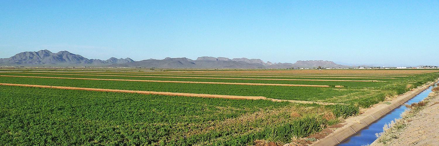
Changes in agricultural land use due to shortages
We found stark differences in agricultural practices driven by water rights priorities.
The Maricopa-Stanfield Irrigation and Drainage District (MSIDD), which holds junior rights, experienced a roughly 30 percent decrease in cultivated farmland between 2020 and 2024, with the biggest reductions beginning in 2022 following the onset of declared shortages. Fields that would normally be planted during the warm season were left uncultivated.
In contrast, the Ak-Chin Indian Community, which holds senior Tribal water rights, maintained near-total cultivation, around 99 percent, consistently throughout the shortage period.

Water scarcity also led to notable shifts in crop cultivation patterns. For example, farmers with junior water rights in MSIDD significantly altered their crop choices by sharply reducing water-intensive crops.
Alfalfa cultivation dropped by 48 percent and corn cultivation declined by 70 percent. Conversely, low-water demanding barley surged by 159 percent, clearly reflecting an adaptive shift towards less water-demanding agriculture.
In contrast, Ak-Chin farmers with senior Tribal water rights continued diversified crop rotations, demonstrating flexibility and stability due to their secure water allocations.

Water sourcing and groundwater dependency
We also evaluated the gap between crop water use, using evapotransportation as a proxy, and known surface water inputs computed from CAP deliveries and precipitation data.
For MSIDD, this gap, referred to as the water balance residuals, were consistently negative throughout the study period, indicating surface water sources alone could not meet crop water demand. The deficit widened significantly after 2022, increasing from 26,000 acre-feet in 2020 to 92,000 acre-feet in 2024, pointing towards growing dependence on sources other than CAP water and precipitation, most likely groundwater pumping.
In contrast, water balance residuals in Ak-Chin remained consistently near zero, suggesting that its surface water supply continued to meet demand throughout the study period.
Looking ahead
Our analysis shows just how much water rights can shape the options that agricultural water users have to respond to crises. While senior Tribal water rights allowed the Ak-Chin Indian Community to continue farming steadily, the more junior water users in MSIDD had to cut back by leaving fields uncropped, switching to less water-intensive crops and relying more on groundwater.
This type of analysis can be expanded to other irrigation districts to better understand the broader effects of water scarcity across regions. Leveraging the strength of high-resolution imagery, we can build a clearer picture of how agriculture is evolving under water scarcity and how to support smart planning for the future.
“The methodology demonstrated here can be applied to other regions in the Colorado River Basin that have recently been subject to hydrologic shortages,” says Enrique Vivoni, Director of the Center for Hydrologic Innovations and the Fulton Professor of Hydrosystems Engineering at Ira A Fulton Schools of Engineering.
Vivoni adds that “due to the more limited water supplies in the Colorado River, it will become increasingly important to carefully track changes in cropping patterns and agricultural water use as part of negotiated efforts to reduce consumption.”
About the author: Shraddha Sharma recently completed this research as part of her Master’s degree in Civil, Environmental and Sustainable Engineering at Arizona State University under the mentorship of Prof. Enrique Vivoni and Dr. Zhaocheng Wang.
Related stories: